24/7 Security
For extra peace of mind in and around our masterplanned community, Bingara Living security cars patrol the streets and surrounding areas, 24 hours a day, seven days a week.
Register for the next
land release
Be the first to know!
Register your interest today
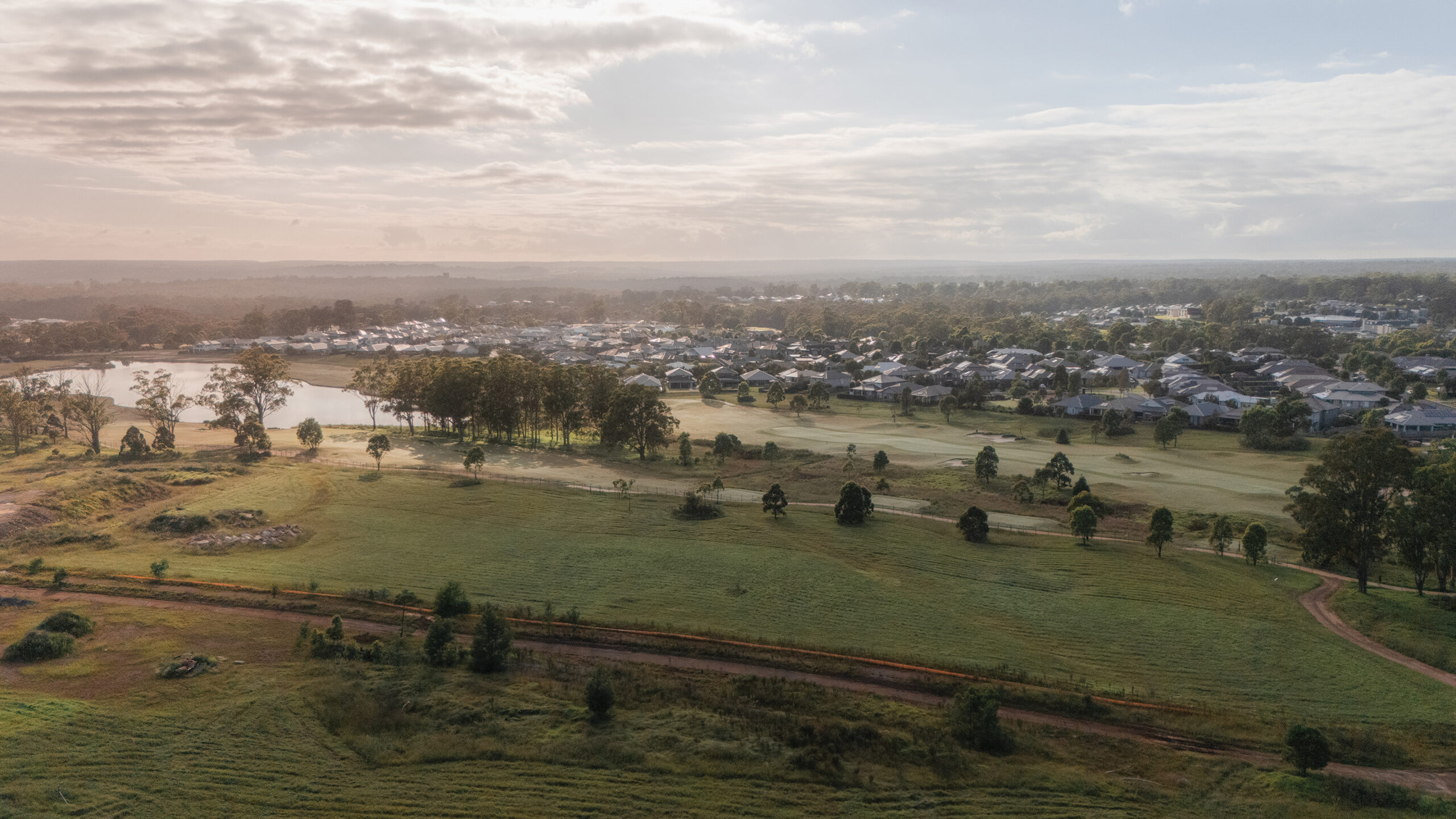
Nestled in the heart of a breathtaking, natural setting, Bingara Gorge invites you to enjoy a contemporary lifestyle complete with vibrant eateries and retail, a modern gym, education and a world-class 18-hole golf course – all on your doorstep. Families in every size, shape and life stage can select from an affordable range of spacious house and land packages that capture the beauty – and convenience – of this unique, semi-rural setting. A tranquil, yet connected, life awaits in one of the Macarthur region’s most coveted suburbs.

At Bingara Gorge, a contemporary, well-built house is just the beginning of a beautifully appointed life. This safe and welcoming community places a high priority on health, well-being and connectivity. From around the clock security and exclusive fitness club access to a world-class golf course and regular landscape maintenance, life at Bingara Gorge is unparalleled.

For extra peace of mind in and around our masterplanned community, Bingara Living security cars patrol the streets and surrounding areas, 24 hours a day, seven days a week.

Common property which includes the community’s parklands and reserves are regularly maintained by Bingara Living on behalf of each precinct’s owner’s corporation.

A popular community amenity, the Pulse Fitness Club is operated by Bingara Living and boasts world-class facilities, personal training programs and group fitness classes.

Designed by acclaimed Australian golf course architect, Graham Marsh, our unique 18-hole course weaves through the magnificent Bingara Gorge landscape. It features five tees per hole and will excite and challenge players of all levels.
Increased Government investment into the area will create additional schools, new roads, improved transport connections, a new town centre and much more.


Schools
Learners of every age will benefit from quality education in Bingara Gorge. From the local Wilton Public School and childcare services to highschools and world-class universities just a short drive away.


Golf course
Designed by acclaimed Australian Golf Course architect, Graham Marsh, this unique course is set in magnificent natural surroundings. It features five tees per hole and suits all levels of players.


Gym & pool
Enjoy a workout in the modern, light-filled fitness centre with a fully-equipped gym. Or swim a few laps in the pool. Residents also have access to fitness classes as well as a yoga and pilates room.


Mountain bike trail
The Bingara Gorge Bike Park provides hours of exhilarating fun for all ages and abilities. The concept plan for the trail loop is around two kilometres and can be found on the Western North side of the estate.


Parks
Greenbridge East Park and Bingara Gorge Park feature playgrounds, BBQ and picnic areas, skate and dog parks. The secluded oasis, Fairways North Park, is also coming soon. Designed around a stunning water feature, this new park is set to become a local favourite.


Retail
Wilton village includes a range of modern conveniences including a Woolworths Metro, beauty and health services as well as a vibrant cafe and restaurant scene. Coles is also coming soon.
The Bingara Gorge story has only just begun. To keep in the loop on all the latest, exciting developments, news and events, register your details here. The best of Bingara is yet to come.
